One should start at the end, and the end is this: Patagonia is spectacular. It's also a long way to travel, and loaded with tourists at the height of summer. But none of those things should hold you back from going.
It is, of course, an enormous region. It's well worth doing some research—its history is complicated and tells of the true remoteness of the place. It really does cover two countries and is much further south than any other continental landmass—Cape Horn at the bottom of South America is over 1,300 miles south of the Cape of Good Hope at the bottom of South Africa.
Overall Itinerary
We struck a balance between trying to see some without trying to see all. Our basic itinerary centered on doing the W Trek in Torres del Paine National Park. We built the rest of the time around this:
- Seattle to Punta Arenas - 3 flights to the southernmost city in the world
- Punta Arenas to Puerto Natales - Get ready to head to the park
- Torres del Paine National Park - 5 days and 4 nights doing the W Trek
- Puerto Natales to Santiago - 1 night getting out of the park and then flying to Santiago the next day
- Santiago to Seattle - After spending 2 nights in Santiago exploring and recovering, we headed home to Seattle
Punta Arenas
The largest city this far south feels like it should—on the shores of the Strait of Magellan, the wind races across the city at all times. The sun is up forever in summer and the rain falls every few hours. The city itself is surprisingly well appointed, likely due to the port and its central role in access to the Antarctic.
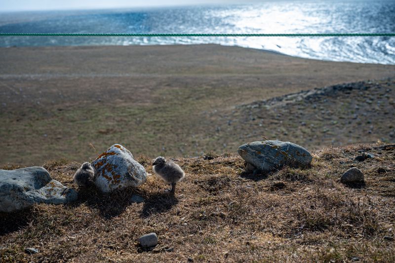
There aren't a ton of sights, but there are lots of excursions that leave from town. We did a morning trip to see the Magellanic penguins on Isla Magdalena in the Strait, which was made all the more epic by the fierce wind blowing that day. The island, part of Los Pingüinos Natural Monument, hosts over 60,000 breeding pairs of Magellanic penguins from October to March. The ferry ride takes about 1-2 hours each way.
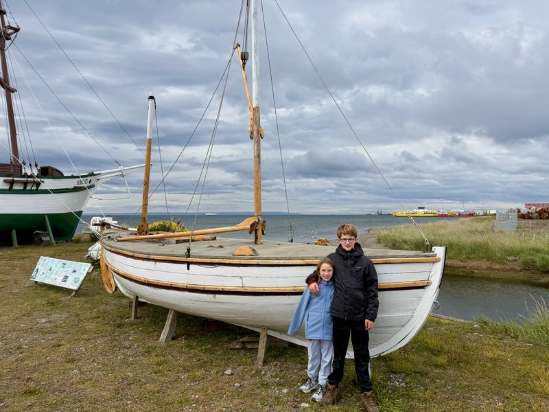
There are also full-size replicas of famous ships at the Museo Nao Victoria on the outskirts of town, well worth the inexpensive cab ride to see what Shackleton took across the most dangerous stretch of ocean in the world. You can also see a replica of one of Magellan's ships and the HMS Beagle, where Darwin formed critical theories on evolution.
But, in truth, don't expect a lot out of Punta Arenas—and if it's Christmas or New Years, expect most of it to be closed. We enjoyed it and felt ready to start our trek after seeing this remote outpost.
Puerto Natales
A surprisingly long bus ride north (about 3 hours, 150 miles) through truly remote, flat landscapes got us to Puerto Natales. Surprisingly, this city is both the gateway to big national parks in Chile as well as being a sea port, connected to the ocean via a series of channels.
Tourism clearly dominates in summer but the same warning about holidays persist. Little was open on Christmas, which was fine by us, but meant last minute provisioning or supplies would have to wait.
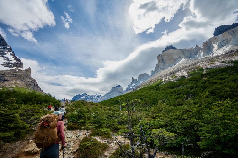
The W Trek
This was the anchor of our journey. It was our entire reason for coming so far. We had done some hiking as a family, but not really much backpacking. Our youngest (8) was now old enough to carry a pack and walk meaningful distances—and coupled with the refugio system meant we could do a real, true trek.
I can't claim to fully understand what the allure of Patagonia was over me. It also seemed like a mythical place that exists only in adventure magazines and documentaries. The ideal of wild places thrills me and acts like a magnet. Their inaccessibility is a feature, not a bug, and compels incredibly long journeys to get there.
I recognize the inherent conflict in drawing on so many resources to get these wild places. I am deeply conflicted, but also feel it is important to bear witness to them. Not protect them in the abstract or only experience them through TV screens. The very snow and glaciers that thrilled me are threatened by the transportation I used to get there. At this point I can only recognize the tension as I don’t have a system to solve it.
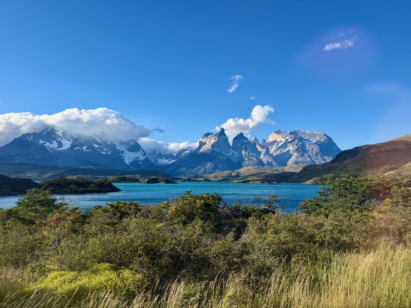
Torres del Paine National Park and its mountains rise out of almost flat plains. Like Mt. Rainier in Seattle, the peaks dominate the surrounding landscape, appearing impossibly big even from vast distances. Within this small park there are so many different types of mountains and geology that every new angle unveils a new view. Any attempt to capture the whole fails because it flattens a multi-dimensional space.
This landscape feels like a cathedral to creation to me. I can almost feel the cosmos brewing and just about reach out and touch the very moment of creation. The immense power of creation on display but the fragility of how it all hangs together—constantly eroding, shifting, getting trampled on—feels so poignant. The time scale both geologic but also human all at once.
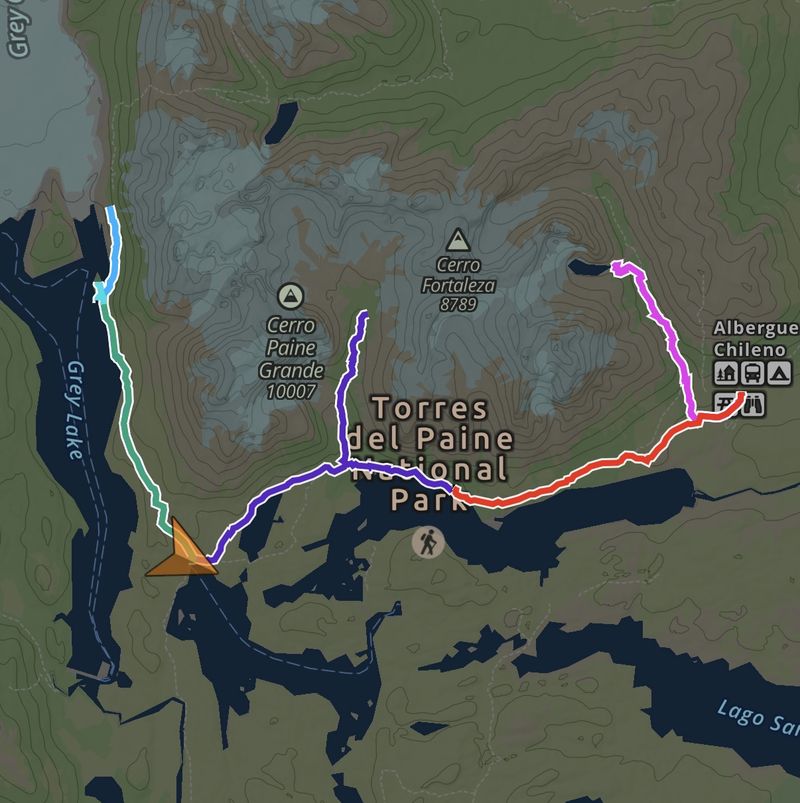
Everyone's actual itinerary on the W is slightly different. It's defined by what sort of accommodations you want (or can get). We were able to secure 4 nights and did the trek east to west.
Important: Accommodations on the W Trek must be booked well in advance, especially for the December-February high season. The park requires all overnight stays to be pre-booked—no wild camping is permitted. Book 6+ months ahead if possible.
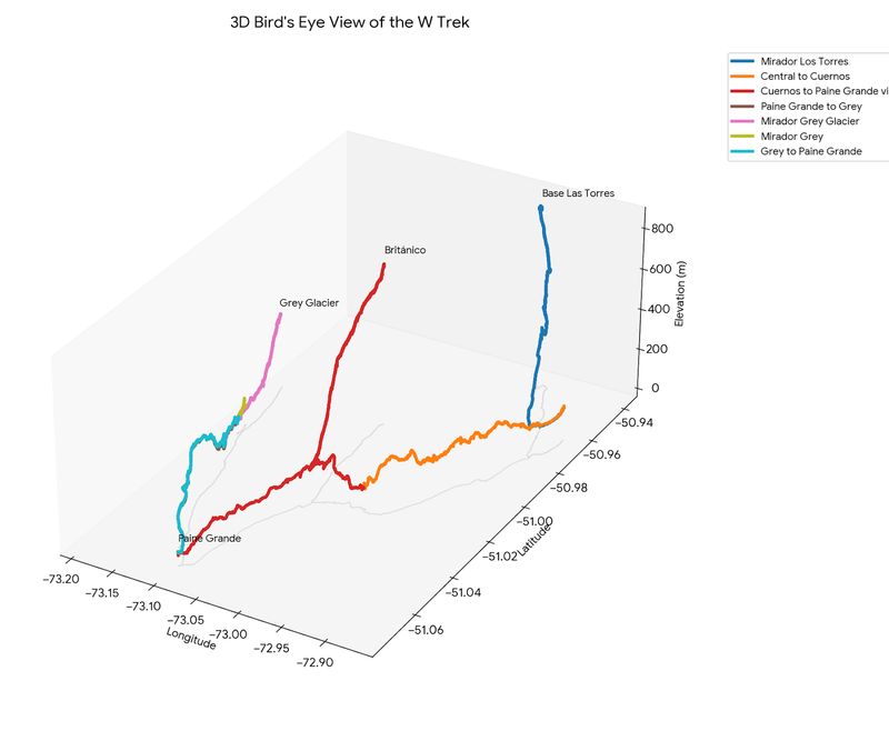
Our flow (all distances and elevations captured by Gaia on an iPhone 17 Pro):
| Day | Route | Campsite | Distance | Elevation Gain (Feet) |
|---|---|---|---|---|
| 1 | Mirador Las Torres Round Trip | Central Tents | 12.26 | 3082 |
| 2 | Central to Cuernos | Cuernos Tents | 7.67 | 785 |
| 3 | Cuernos to Británico to Paine Grande | Paine Grande Tents | 15.22 | 2709 |
| 4 | Paine Grande to Grey | Grey Tents | 6.72 | 1015 |
| 4 (afternoon hike) | 2nd Swing Bridge Round Trip | 4.55 | 909 | |
| 5 (morning hike) | Mirador Grey | 1.79 | 172 | |
| 5 | Grey to Paine Grande | Bus back to Puerto Natales | 6.64 | 921 |
| Total | 54.85 | 9,593 |
Our complete set of tracks are represented by this map:
But we also had some fun and made a 3D plot of the track data, which really shows the elevation gain and relative positioning of the tracks on the W:
Every turn yields a new view of spectacular scenery. From mountains to glaciers to lakes to windswept vistas, there is an expansiveness that draws you in.
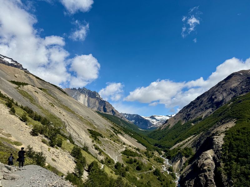
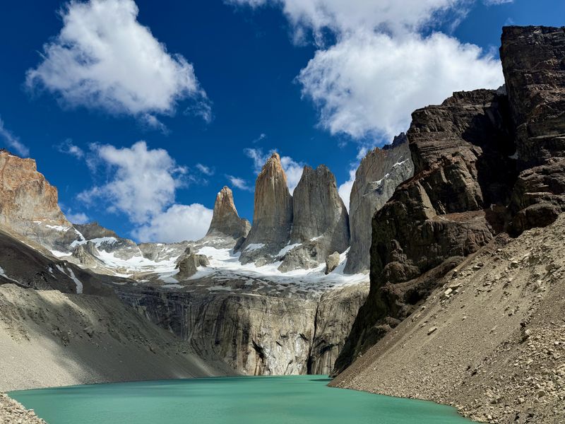
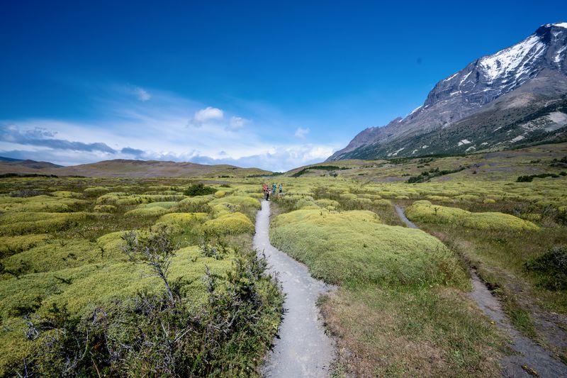
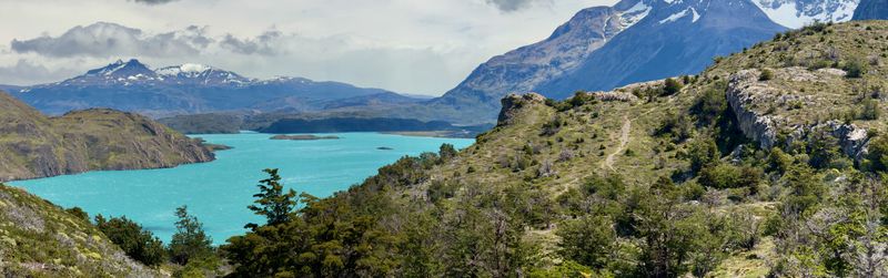
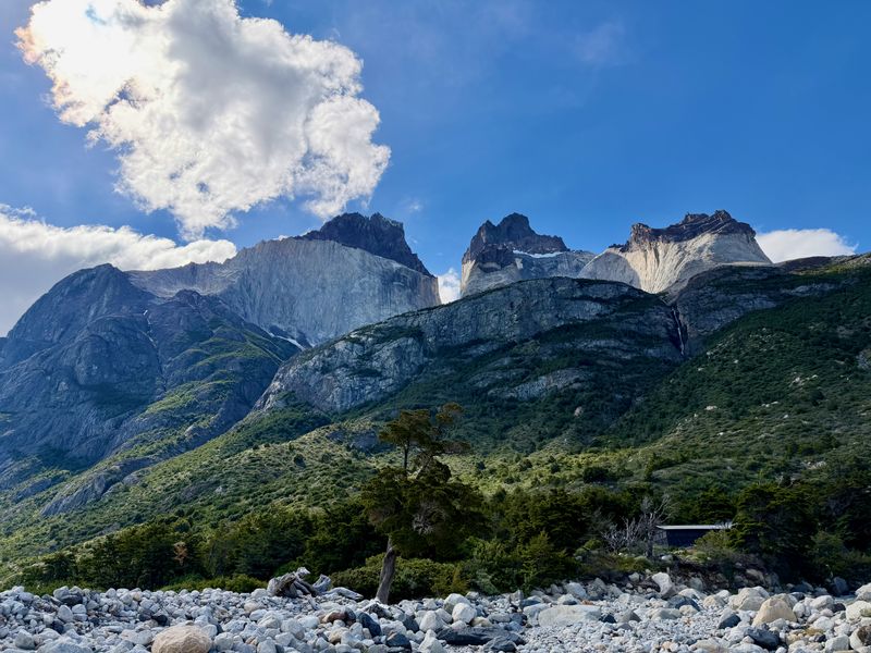
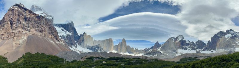
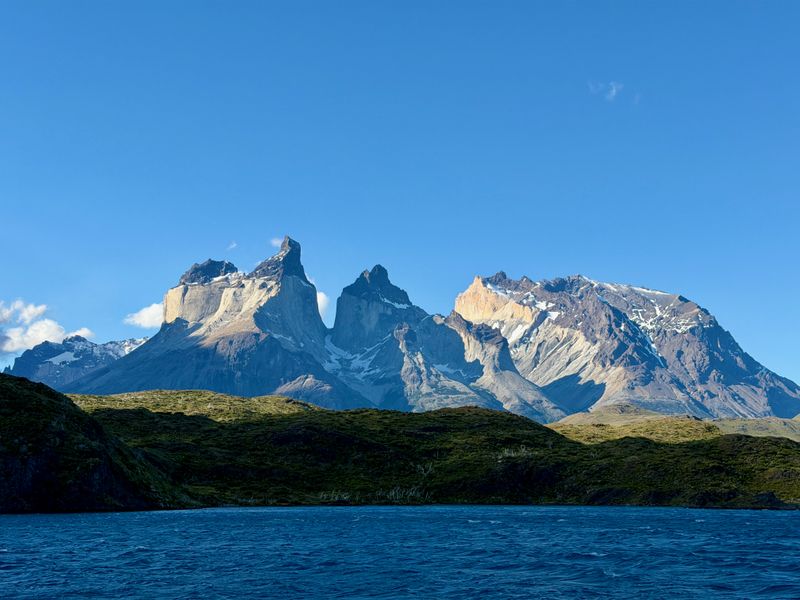
The scenery in Torres del Paine National Park is incredible
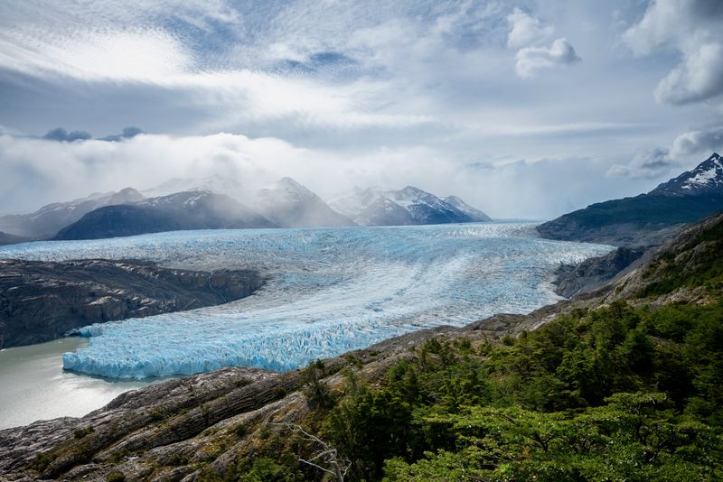
The landscape also felt very alive. On our second day of hiking from Central to Cuernos, we experienced incredibly strong winds. The gusts pushed us around and made us stop many times. On our third day, we saw active avalanches on our way up to Británico. On our fourth day, we saw an active glacier that extended far beyond the horizon. It felt like one could see the primordial forces that shape vast landscapes.
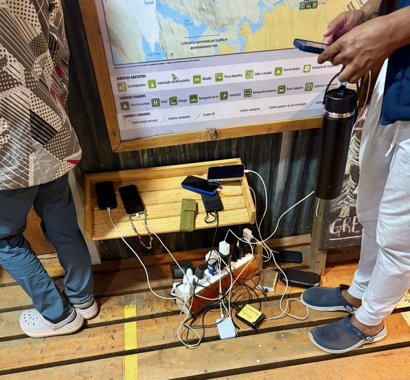
Despite being remote, every refugio provided a charging station for phones and an internet connection for those who wanted to pay. It's astonishing to see just how bound we are. I'll admit I even logged on for 30 minutes to check in and make sure nothing terrible had happened. There wasn't really a need to, but the draw is strong.
Santiago
We finished our trip with a couple of nights in Santiago. It was a quiet period of summer, with everything closed for New Year's Eve and New Year's Day. The city sits right up against the Andes Mountains. It's a lovely place, with parks, old city streets, museums, and lots of government buildings. It reminded us of CDMX in a lot of ways, but clearly it's its own place.
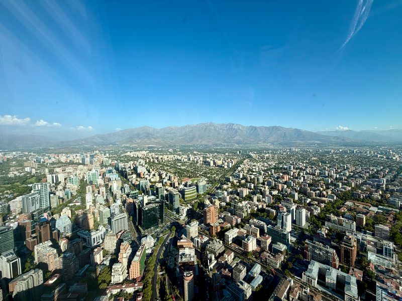
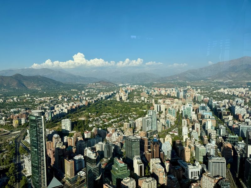
Views from Sky Costanera, the tallest building in South America at 300 meters, offering 360-degree panoramas of Santiago and the Andes
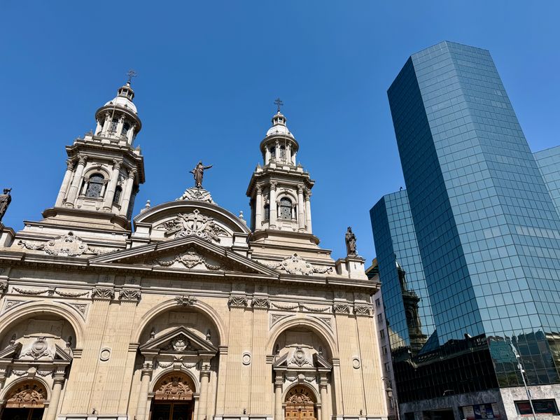
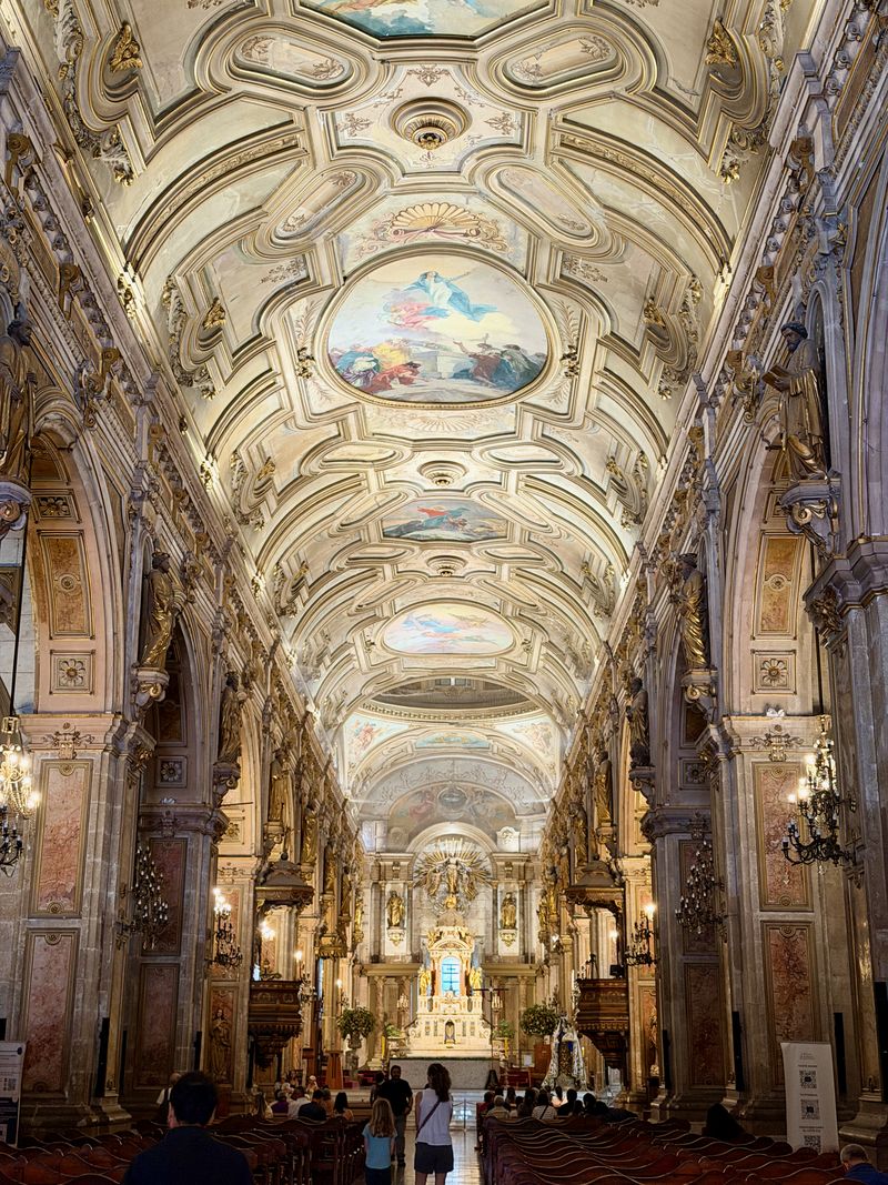
The main cathedral serves as a wonderful juxtaposition between the new and the old